
|
Quick Reference Guide
All the geographic conversions are based on the document Geomatics Guidance Note Number 7, part 2, Revised July 2012 released by International Association of Oil & Gas Producers.
The ellipsoidal distances are computed with the Vincenty's formulae.
This program have two methods to create the route.
MANUAL INPUT
This will be incorporated in a future release.
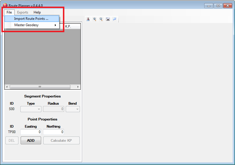
AUTOMATIC INPUT
Select Import Route Points… from the File menu.
Select the text file to import and click Open
The program will automatically evaluate and store the route.
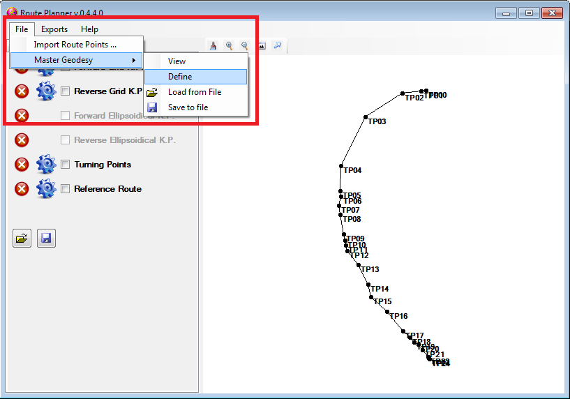
OPTIONAL
Configuration needed for the geographic coordinates and distances.
To define the geodesy of the route there is two options.
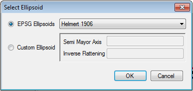
MANUAL INPUT
Select an ellipsoid from the list of the EPSG ellipsoids OR manually input the dimensions of a custom ellipsoid.
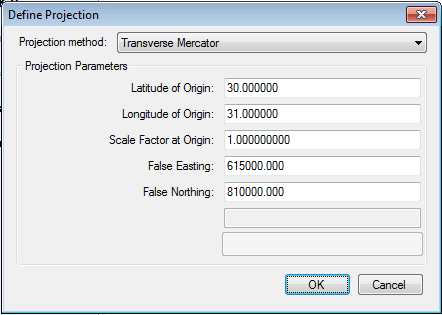
MANUAL INPUT
Select the projection method.
Then set the parameters of the selected projection.
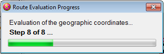
With the coordinate reference system defined, the program start to evaluate all the geographic coordinates and distances of the loaded route.
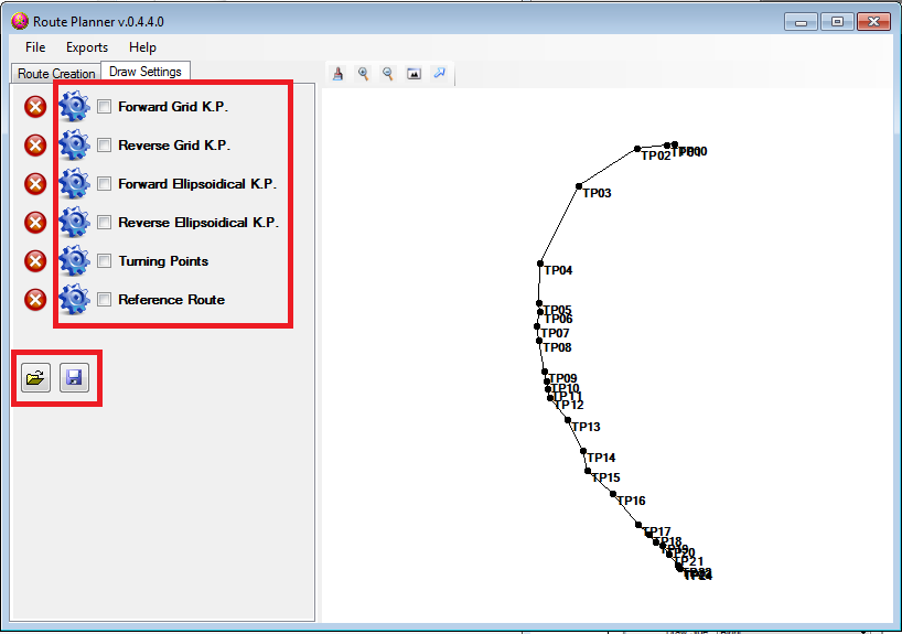
Now you have to set the properties for each element that you want to plot.
Click on the gear, next to the element, to set the relative parameters.
Through the Settings menu you can load or save the configurations from a file.
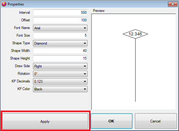
K.P. flag properties:
Change the plotting parameters and then click on the Apply button to update the preview on the right.
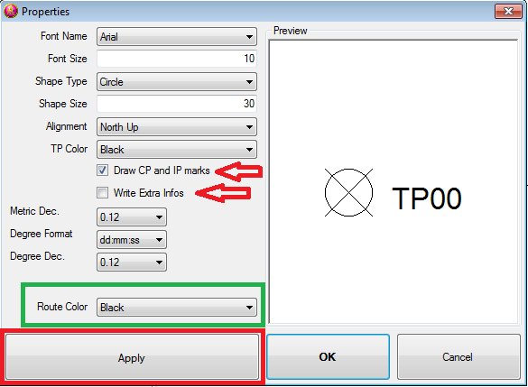
Points and Route properties:
Change the plotting parameters and then click on the Apply button to update the preview on the right.
Is possible to activate the plot of the CP and IP points.
Is possible to write the coordinates for all the points and the K.P.s for the TPs.
In this window you can also select the color of the route.
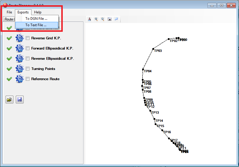
There are two export options.
The first option is to export the listing of the route as text.
Click on Export to Text file … from the Exports menu.
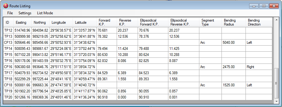
In the window you can see the list of the available information for each vertex and segment of the route.
With the Settings menu is possible to change the format of the values.
With the List Mode menu is possible to switch between the Route and the KP listing.
Then with the File menu is possible to save the list in one of the available formats.
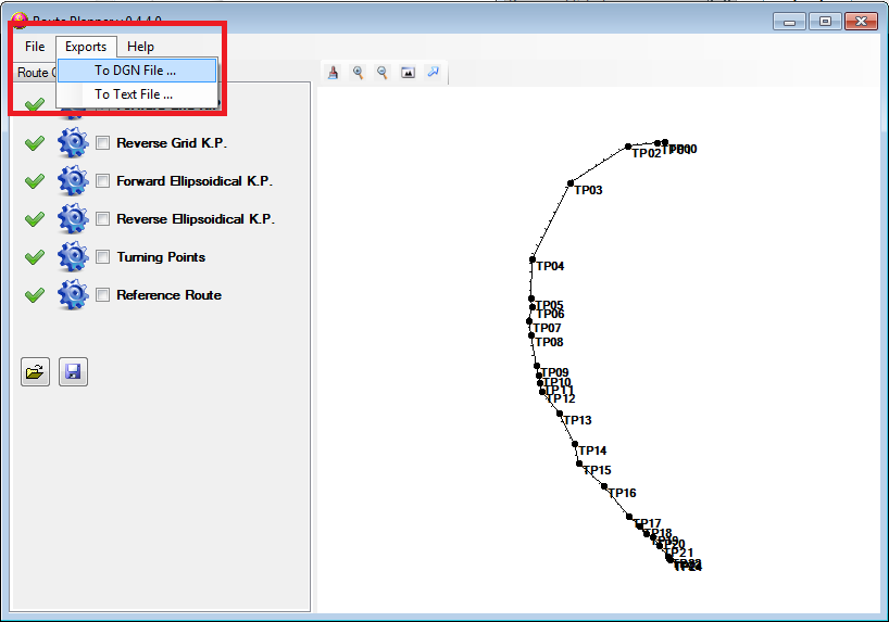
The second option is to export the route in a dgn file.
Click on Export to DGN file … from the Exports menu.
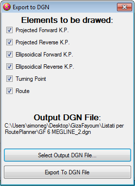
In the window you can select witch elements you want to draw inside the dgn file.
Note: the elements will be drawn according to the settings of the preview window.
With the Select Output DGN File… button select a dgn file.
Then with the Export To DGN File button the program start to write inside the selected dgn file.
There is also a third export available only when a datum is defined.
This extra export let you create a Kml file that you can visualize in Google Earth.
Click on Export to KML file … from the Exports menu.
ROUTE DEFINITION FILE
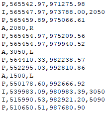
The format of the text file that contain the route information need a particular format to be recognised by the program.
2015-02-06 RoutePlanner - Rev: 0.5.0.1
Bug fixing.
This app require: .NET FrameWork v4 and Bentley MicroStation XM
Get application | Source code not available
2014-02-07 RoutePlanner - Rev: 0.5.0.0
The manual input of the route will be redesigned in a future release.
Several graphical improvements.
Bug fixing.
This app require: .NET FrameWork v4 and Bentley MicroStation XM
2013-07-02 RoutePlanner - Rev: 0.4.6.0
Bug fixing.
This app require: .NET FrameWork v4 and Bentley MicroStation XM
2013-01-22 RoutePlanner - Rev: 0.4.5.2
Bug fixing.
This app require: .NET FrameWork v4 and Bentley MicroStation XM
2013-01-18 RoutePlanner - Rev: 0.4.5.0
Added the export in to a KML files.
Bug fixing.
This app require: .NET FrameWork v4 and Bentley MicroStation XM
2012-11-19 RoutePlanner - Rev: 0.4.4.1
Added a library of Coordinate Reference System and Configuration files.
Bug fixing.
This app require: .NET FrameWork v4 and Bentley MicroStation XM
2012-11-14 RoutePlanner - Rev: 0.4.4.0
Full implementation of the IPs (plotting and listing).
GUI bug fixing.
This app require: .NET FrameWork v4 and Bentley MicroStation XM
2012-11-06 RoutePlanner - Rev: 0.4.3.0
Updated the geographic module.
This app require: .NET FrameWork v4 and Bentley MicroStation XM
2012-10-22 RoutePlanner - Rev: 0.4.2.0
DGN export bug fixed.
Added a new point definition for the import of the route informations.
This app require: .NET FrameWork v4 and Bentley MicroStation XM
2012-10-17 RoutePlanner - Rev: 0.4.1.0
Drag-Drop bug fixed.
This app require: .NET FrameWork v4 and Bentley MicroStation XM
2012-10-15 RoutePlanner - Rev: 0.4.0.0
Improvement of the geodetic module.
Bug fixed.
This app require: .NET FrameWork v4 and Bentley MicroStation XM
2012-09-14 RoutePlanner - Rev: 0.3.1.0
Added the quick help.
This app require: .NET FrameWork v4 and Bentley MicroStation XM
2012-07-17 RoutePlanner - Rev: 0.3.0.0
Added the geographic information module.
This app require: .NET FrameWork v4 and Bentley MicroStation XM
Get application | Source code not available
2012-05-10 RoutePlanner - Rev: 0.2.3.0
This application are designed to draw into a DGN file the KP flags, the reverse KP flags and the construction points of the route (TPs & CPs).
This app require: .NET FrameWork v4 and Bentley MicroStation XM


